Wetland Buffer Info & Map
 A wetland buffer is a setback area between a stream, river, or wetland and any upland development. It maintains the natural vegetation cover along the waterway, which is an essential part of the aquatic ecosystem. A wetland buffer is a simple land management practice that is employed by municipalities to protect property and conserve natural resources. In addition to protecting natural resource areas, buffers are the least expensive way for municipalities to protect homes and roadways from flood damage, manage floodwater, and to protect water quality.
The City of Portsmouth has a 100-foot buffer adjacent to all of its wetlands (including most tidal areas) greater than 10,000 square feet or about a quarter of an acre. The City limits what is allowed in this buffer to activities that are compatible with protecting the natural resource value of the buffer and adjacent wetland areas. New construction, ground disturbance and fill or removal of soil are not allowed in the Wetland buffer without a City Conditional Use Permit.
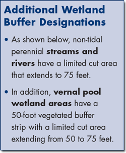
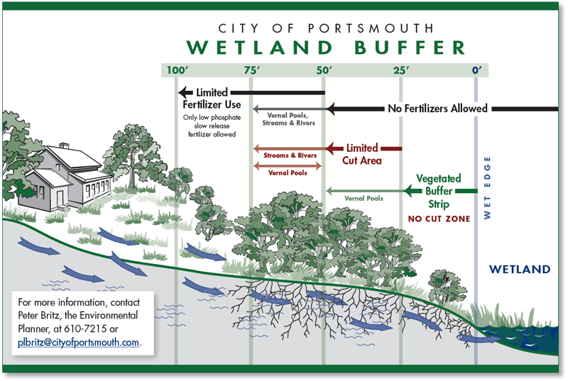
In Portsmouth, the first 25 feet from the edge of a wetland area is known as the Vegetated Buffer Strip (see below). Within this area, cutting and clearing of vegetation is not
permitted unless it is to remove invasive species by hand. Between 25 and 50 feet, the City has a Limited Cut Area. In this area, property owners may cut up to 50% of the trees that are greater than six inches in diameter dbh (the diameter of the tree at 4.5 feet up from the ground). The use of fertilizer is prohibited in both the vegetated buffer strip and limited cut area. Beyond the limited cut area, only low phosphate and slow release fertilizers are allowed in the wetland buffer.
If you are planning on doing any work in the wetland or wetland buffer, it is always a good idea to check with the City before going ahead to make sure you do not need a conditional use permit. You can contact Peter Britz, the Environmental Planner at 610-7215 or plbritz@cityofportsmouth.com with any questions.
Additional Information
- Download the Wetland Buffer Flyer
- Citywide Wetlands/Prime Wetlands Map
- Zoning Ordinance see Article 10, "Environmental Protection Standards "
- New Hampshire Coastal Watershed Conservation Plan
- Why Are Wetlands Important? (National Parks Service)
- Wetlands Factsheet (EPA)
